Corcaigh Ceann an Domhain
Abstract
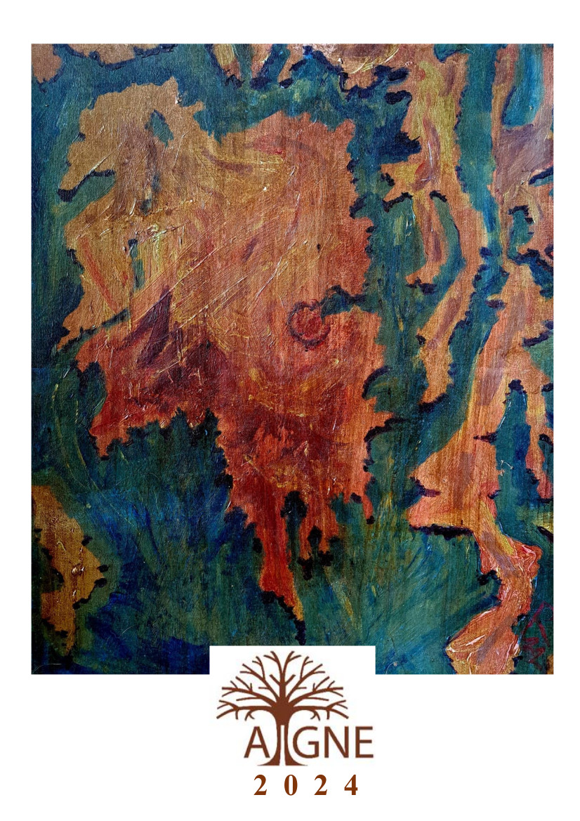
This map is entitled Corcaigh Ceann an Domhain (“Cork, the Head of the World”), which is inspired by the Latin phrase Roma caput mundi. It is painted with acrylics on canvas board, and finished with coffee stain and shellac, and the map is orientated to the east. The aim was to make a map from the perspective of Cork being at its centre and distort the world around it. The central landmass is Ireland with a disproportionately sized Cork: on the left is the Shannon estuary, and further above is Galway Bay and Lough Neagh. Surrounding Ireland is Iceland on the lower left, Iberia on the lower right, Norway and Britain to the top, and India and the Caspian Sea at the top right. The map is inspired by medieval world maps, or mappae mundi (in particular, the Cotton World Map found in a manuscript held in the British Library - Cotton MS Tiberius B. V, f. 56v) which were produced in what is now Britain, France and Germany from the eleventh to the fifteenth centuries.
References
Downloads
Published
Issue
Section
License
Copyright (c) 2024 Richard Keyes McDonnell

This work is licensed under a Creative Commons Attribution-NonCommercial-NoDerivatives 4.0 International License.
For our full Copyright Notice see our Author Guidelines.